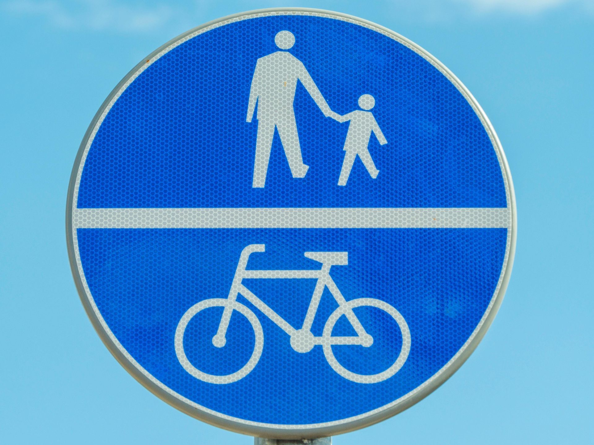
Oceanside-Netarts Mixed Use Path

This team's mission is to work with county and state road agencies to design, develop and implement a mixed use walking/cycling path connecting Netarts, Oceanside, and the lighthouse. So far the team is very small, officially only having one Oceanside community member (Gill Wiggin) but in the last several weeks I have reached out to a few locals whose knowledge I believe will be indispensable in this project and am waiting on official answers. 


With the help of OAP a meeting was held in December that included Chris Laity of the Tillamook Country roads department and Caroline Crisp from ODOT. The goal of the meeting was to help us get started on the project, hopefully getting it included in the next Transportation System Plan(TSP) for the county. They offered great advice and some useful next steps, these included:


  • Putting together a map of potential routes, including the pros/cons of each
  • Proximity to the highway will make more grants available
  • Community involvement and support will be crucial, this includes participating in public comment periods for the TSP
  • Think big picture to identify opportunities and constraints


Following their advice we met to start mapping potential routes along with strengths and weaknesses of each. While keeping the route in the public-right-of-way on the uphill side of the highway is the most obvious and preferable it is still important to have alternate options in case of unforeseen obstacles. 


For now this team is in a bit of a holding pattern but working to complete the route option plans soon. This project will require a lot of community engagement and I will do my bet to keep people informed of opportunities to help. 

If you feel like you would be a good fit for this team please reach out on the website. Go to “Mixed Path Team” under the Projects banner and click the “I want to join” button to get involved.

Join Us
February 10, 2026
Help Us Find the Potholes and Stormwater Drains Put on your walking shoes and join the fun. We’re launching a community‑wide treasure hunt to locate potholes and stormwater drains that need attention. Every “find” helps improve safety and supports our partnership with Tillamook County Public Works. How to Play See it! Spot a pothole or stormwater drain that needs maintenance. Snap it! Take a clear photo and note the nearest street names or landmarks. Report it! Email your photo and location to: david@daviddulaney.com Track it! Visit https://www.oceansideactionpartnership.org/roads-and-parking to view the live map and watch the community’s progress. Contest Rules Each verified pothole or stormwater drain report earns 1 ticket . Size doesn’t matter—every pothole counts. Credit goes to the first person to report each location. Your total number of verified finds equals your total number of tickets. All tickets will be placed into a drawing at the next OAP community event. Prizes 10 winning tickets will be drawn. Participants can win multiple prizes . Prizes include OAP sweatshirts, T‑shirts, and posters . A Grand Prize will be awarded to the participant with the most verified finds . Safety First Please be safe and responsible when exploring and photographing. Follow general safety guidelines at all times—stay aware of traffic, weather, and your surroundings. Contest Deadline The treasure hunt officially ends at midnight on April 30, 2026 . What Happens Next The OAP Roads/Parking Team will use the completed maps in partnership with Tillamook County Public Works . The County will train our volunteers in pothole analysis and repair techniques and provide materials. Our volunteers will supply the labor—another example of Oceanside neighbors working together.
February 6, 2026
Roads and Parking Team Update February 6, 2026, by David Dulaney, Team Coordinator 
January 27, 2026
Trails Team Update January 26, 2026, Bob Sprague, Team Coordinator
More Posts